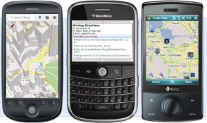
It is possible to plan trips on Trinity Transit using Google Maps. It is also possible to plan trips that use connections with neighboring services that include data in Google Maps. These services include Redwood Transit System, Redding Area Bus Authority, Amtrak Coast Starlight and Redwood Coast Transit.
Google Maps for Android
 Google Maps is available, at no cost, with Google Maps for Android. Transit features in Google Maps for Android include trip planning, nearby stops, and itinerary navigation. You can also access maps.google.com from many mobile devices including iOS devices.
Source data
Data for Trinity Transit service information (schedules, stop locations, route alignments, fares, and service calendar) is made available in the General Transit Feed Specification (GTFS) format. Download the data file at the GTFS Data Exchange website. This data is maintained with the support of Trillium Solutions, Inc.
Additional 3rd party transit information applications
Many other websites and applications incorporate transit data besides Google Maps. Browse these applications at City-Go-Round.
Terms and conditions
We strive to provide quality information through Google Maps, but we can’t guarantee 100% accuracy. Use the trip planner as a first step for planning purposes only. We recommend riders double-check trip itineraries with the printed bus schedules and other sources. Neither this transit agency, nor any other, nor the designer of this site, will be held responsible for any mishap which may result from using Google Maps transit itineraries. Also see the Google Maps Terms and Conditions.
What should I do if I receive incorrect, misleading, or confusing trip itinerary information?
If your trip itinerary has inaccurate stop location, time, fare, or service schedule information, this is likely because of an error in the information this or another transit agency has provided to Google Transit. Record the start address, end address, and arrival/departure date & time for your itinerary and contact the appropriate transit agency to tell them about the problem so it can be fixed.
If your problem is with inaccurate or misleading walking directions, awkward transfers, or any problem with the visual map and route display, your issue is probably best addressed directly to Google. Use the report a problem feature of Google Maps or contact Google regarding transit-related issues using this form. Please consider contacting transit agency staff as well, so they can be made aware.